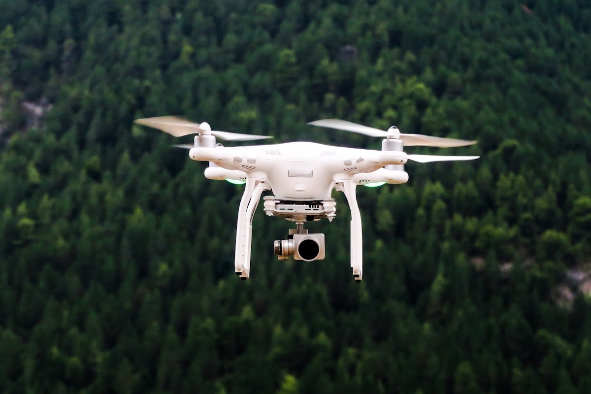
Drone footage is one of those tools that gets used a lot more than it should. It’s become almost reflexive: big project, complex site, outdoor location, let’s get the drone up. And sometimes that’s exactly right. But plenty of the time, the aerial shot adds a nice visual flourish to a video and then everyone moves on having gained nothing.
The question worth asking before any drone goes up is not “would this look cool from above?” It’s “does an aerial perspective add information or feeling that the content couldn’t communicate otherwise?” If the answer isn’t clearly yes, keep the drone in the case.
This post is about when the answer genuinely is yes, and why it matters to make that distinction.
What Drone Footage Actually Does Well
The aerial perspective does a small number of things exceptionally well, and those things come up in specific contexts.
The first is scale. When a project, site, or landscape is large enough that a ground-level camera simply can’t show it in full, a drone solves that problem. A construction site that covers several hectares, a property with significant grounds, an event with thousands of attendees spread across an outdoor venue: these are subjects where scale is genuinely part of the story, and where the aerial perspective is the only way to tell it.
The second is context. Sometimes the value of a location or project isn’t apparent until you see where it sits in relation to everything around it. A new development and its relationship to the surrounding suburb. A vineyard in a valley with hills on three sides. A school campus and its grounds. Ground-level cameras can’t give you that relational view. A drone can.
The third is access. There are locations that are genuinely difficult or impractical to photograph from the ground in any useful way. Rooftops, large structural installations, coastal formations, steep terrain. A drone can reach angles that would otherwise require scaffolding, helicopters, or just wouldn’t be possible at all.
When Drone Footage Genuinely Earns Its Place
Property and Construction
This is the most consistent use case for drone footage, and it’s one we see play out reliably. When a property’s appeal is partly or substantially about its setting, drone footage communicates that setting in a way that no amount of ground-level photography can match. The view from the hill, the proximity to the river, the layout of a large rural block: these things need to be seen from above to be understood.
For construction projects, progress documentation is another strong use case. Showing a site’s evolution from bare ground to completed structure over time is genuinely compelling, and an aerial perspective makes the full scope of that progress visible. We’ve written about how this fits into a broader content approach in our post on content for property and construction businesses.
Large-Scale Events
Events that have real crowd presence or that use outdoor space in significant ways benefit from aerial coverage. A festival crowd at capacity, an outdoor market spread across a park, a charity fun run with a thousand participants: these are moments where the aerial view adds something. It communicates energy, attendance, and scale in ways that a ground-level camera, no matter how good, can’t replicate.
For events held indoors or in compact spaces, the calculus changes quickly. If the venue is small enough that a wide-angle lens does the same job, the drone adds nothing. Our post on when you need event coverage covers this in more detail, including how to think about the right mix of ground-level and aerial content for different types of events.
Landscape-Heavy Subjects
Some subjects are, by nature, best understood from above. A new urban park. A golf course. A rural tourism property. A coastal headland walk. When landscape is the product or a major part of the appeal, aerial photography can do in a single frame what a ground-level gallery of twenty photos can’t quite achieve.
Before-and-After Documentation
For large-scale landscaping, site remediation, land development, or similar projects, a drone is often the only practical way to show the full extent of the change. Before-and-after pairs shot from the same aerial position at the same altitude are among the most convincing project documentation content available. The transformation is immediate and undeniable.
When You Really Don’t Need It
If the subject is contained, intimate, or detail-focused, drone footage usually adds nothing and can actually work against you. A cafe, a retail space, a portrait session, a small product launch, a consultation-based service: none of these are improved by an aerial perspective. In these contexts, adding drone footage can make a video feel generic, as though the aerial shots are there to pad the runtime rather than because they mean anything.
There’s also a risk of drone footage signalling effort over substance. A beautifully shot aerial sweep of a suburban office block doesn’t communicate anything useful to a prospective client. It just says “we used a drone,” which isn’t a business message.
Before booking a drone operator, ask: if this content had no aerial footage at all, what would be missing? If the honest answer is “nothing essential,” save the budget and invest it elsewhere. Often, a well-executed ground-level shoot, combined with strong photography, does more for a business than a video with impressive drone shots and weaker ground-level coverage. We’ve written about this trade-off in our post on when photography alone is enough.
Practical Considerations Worth Knowing
Beyond the creative question of whether drone footage adds value, there are practical realities that affect whether and how it can be used in a given project.
Regulatory requirements in Australia mean that commercial drone operations require a licensed Remote Pilot Licence and, in many cases, additional approvals. Flying in or near controlled airspace, national parks, or above crowds requires specific permissions that take time to obtain. If drone footage is part of your brief, build lead time into your planning.
Weather is also a real constraint. Drone footage in strong wind is unstable and often unusable. In most Australian cities, there are periods where conditions are simply wrong for aerial work. Having a contingency plan, or scheduling flexibility, means you’re not locked into a date where the conditions make the footage unusable.
And the light matters as much as it does for ground-level photography. Aerial footage shot in harsh midday sun will be flat and uninspiring. Early morning and late afternoon light gives aerial footage depth and warmth. If drone coverage is important to the project, it’s worth scheduling specifically around the right conditions rather than treating it as an add-on to the rest of the shoot day.
The Honest Question to Ask
The best creative decisions are the ones where you’re genuinely honest about what the content needs to do. Drone footage, when it earns its place, is a genuinely powerful tool. It shows scale, context, and access in ways that nothing else can.
But used carelessly, it’s just a visual habit. Another aerial sweep because that’s what you do on a location shoot. Another slow reveal from above because it looks impressive in the edit.
Ask what the aerial perspective adds that the ground-level footage can’t provide. If there’s a clear, specific answer, fly the drone. If you’re reaching for a reason, keep it on the ground and spend that part of the day getting better coverage of what actually matters.
That’s how content decisions should work: start with what the audience needs to see and understand, then choose the tools that serve that outcome.
Want help applying this to your business?
Book a free discovery call →